Tuesday August 26, 2014 Hawaii Vacation
Back to Hawaii Vacation Blog
Daily Blog -
I woke multiple times as usual and finally we got up around 6am. It was raining and overcast so we decided to drive around the island to Koke'e State Park.
It is a 70+ mile drive around the island (clock-wise) to end up 10 miles (as the crow flies) from our condo.
The mountains are impassible, so there is no way to get to the park counter-clockwise from the condo.
We stopped at the Safeway in Kapaa to purchase water (buy the 1 gallon jugs for $1.50, instead of the $11 24-pack bottles).
Next we drove highway 56, then highway 50. We stopped for gas next to the Hanalima Bakery ($4.59/gallon) then got bakery items -
1 coconut turnover (very good), 1 apply turnover (very good) and banana bread (okay).
We continued driving, stopping at Hanapepe Valley Lookout for pictures. This is on Kaumuali'i Highway (50) between Kalaheo and Eleele.
In Waimea community we stopped at the Ishihara Deli to pick up food for lunch. Kathy got a turkey sandwich with bean sprouts (wow!) and Alan bought a bunch mostly seafood Poke
(sounds like Pokey) a Hawaiian lunch staple. We drove up highway 560 “Waimea Canyon Drive” toward Koke'e State Park.
Starting at sea level, the drive is 20 miles and rises to 4176 at the Puu'o Kila Lookout. Along the way we stopped and took pictures at a bunch of the turnouts.
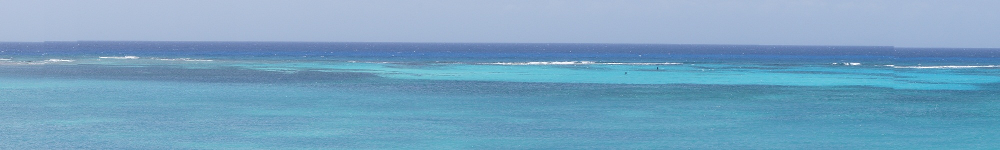
The turnout was at around the 2.5 mile mark and had great views of the south ocean and the 2 uninhabited islands of Ni’ihau and Lekua.
The second turnout was at the 1500 feet elevation sign and was hard red dirt with several small waterfalls.
Waimea Canyon Drive turns into Koke’e Road a few miles further (be careful when driving back down the hill).
We skipped the third lookout Waimea Canyon Lookout due to super slow car. The fourth stop was an actual parking area Pu’u Hinahina Lookout.
We took pictures of the Waimea Canyon (Grand Canyon of Kauai). We stopped and picked up 2 hitchhiking French Canadian Quebec girls looking for a hiking trail.
We drove by the Koke’e Air Defense System (radar). We stopped at Kalalau Lookout and took pictures and then finally stopped at the end of the road at Puu'o Kila Lookout.
There were beautiful views of the northwest coast of the island Na Pali Coast, Kalalau Valley and Ka’a Alahina Ridge. We took lots of photos.
There was a hiking trail to Wai’ale’ale, one of the wettest spot on the earth at 5148’, and to Alakai Swamp (highest swamp). We were too tired and lazy to hike.
We then drove the hitchhiker back down to the canyon trail. We stopped along the way to take more pictures of the Waimea Canyon and Waipo’o Waterfall on the way down.
The trip down was faster due to less traffic. Some people drive at 10-20 mph (speed limit is 25). It is a super curvy road with many steep drop-offs.
Back at the coast, we drove to Salt Pond beach. There we had lunch in one of the pavilions with a group of Hawaiian families.
The waves were huge this day 4-8 feet, crashing on the rocks just off the beach.
Alan tried to snorkel even with the foam making the water visibility from clear to almost zero. Kathy snorkeled for a few minutes, and then ended up talking with a couple for a half hour.
Alan kept snorkeling around the area and finally hit a jackpot finding puffer fish (1 blew up when he tried to touch - yeah) and a baby moray eel. They truly are aggressive.
I got within 4 feet and it darted out about 12" with open month looking mean, and then retreated back under the rock. Luckily it was only about 1" in diameter and maybe 18" long.
It was still exciting and scary all at once. We got out and dried off and continued our touring back toward our condo.
We stopped at Spouting Horn and got quite a few good videos. Looked at the vendors setup at the park (mostly oriental products).
Across the road was the National Tropical Botanical Garden office for the Allerton and McBryde gardens.
We decided to take the Allerton tour, since it went by the trees filmed in the Jurassic Park movie.
The tour started at 3pm and we didn't know that the tour was 2-1/2 hours walking until we were on our way on the bus to the gardens (2 miles away).
We also didn't think about the fact that evening is when the mosquitoes come out. Luckily Bob let us use some of his bug spray.
We had 2 guides - Bob (20 year veteran of the park) and Star (2 year veteran). Bob had been the nursery manager, so he knew almost every plant in the garden. We stopped at almost every one.
There were many edible plants in the park and we were able to sample some of the fruits - some sweet, some sour-sweet, some not so good!
Read the www.ntbg.com website to learn more about the park.
I took many photos while on tour - plants and flowers, water ways, ponds, streams, and also of Kathy at the Banyan (dinosaur) trees.
We finally finished the tour just before Alan ran out of power.
We drove back along the coast to look at other RCI timeshares (they looked pretty old and not as nice as the Cliffs) and to look at some of the south coast beaches
(a lot of waves - good for surfing, bad for snorkeling).
We stopped at Mark's place for dinner. Kathy had a hamburger and Alan had the Tuesday Special - Ahi with mushroom and a sour tomato, rice and pasta (only good).
On the way back we drove thru a few of the RCI properties and went by Lyndgate Beach (has a small rock harbor for snorkeling that was small and had lots of big waves and wind).
We drove back to the Cliffs arriving around 8pm.
Showered and in the bed within 30 minutes and asleep with a few minutes.
Videos -
View of Na Pali Coast and Ka’a Alahina Ridge
View of fast moving clouds at Pu'u Hinahina Lookout
Spouting Horn #1
Spouting Horn #2
Mini-Spouting Horns
Lawa'i Stream (tiny fish jumping)
Soothing sound waterfall
Photo Groups -
Hanapepe Valley Lookout
Ishihara Market
Turnout at 2.5 mile
Turnout at 1500 Feet Elevation sign
Pu'u Hinahina Lookout
Kalalau Lookout
Puu'o Kila Lookout
Waipo'o Waterfall
Spouting Horn
National Tropical Botanical Gardens
Allerton Gardens
Dinosaur Trees
Mark's Place - dinner
Hanapepe Valley Lookout
View Hanapepe valley on Kaumuali'i Highway (50) between Kalaheo and Eleele

Back to Top
View Hanapepe valley

Back to Top
View Hanapepe valley

Back to Top
Ishihara Market
Great deli counter with sandwiches and local Poke for lunch

Back to Top
4 star (flavor good, squid slightly chewy)

Back to Top
3 star (flavor too strong, Ahi fish very good)

Back to Top
3 star (flavor too strong, Ahi fish very good) - recipe on PBS

Back to Top
4 star (flavor good, Octopus good)

Back to Top
5 star (seaweed salad very good)

Back to Top
Turnout at 2.5 mile
View of Ni’ihau island (uninhabited)

Back to Top
View of Lekua island (center) Ni’ihau island (on left)

Back to Top
Panoramic view of the south coast of Kauai Island with Kekaha community

Back to Top
Turnout at 1500 Feet Elevation sign
Kathy at the turnout

Back to Top
Alan and Kathy

Back to Top
Red dirt and small waterfalls

Back to Top
Waterfalls

Back to Top
Waterfall

Back to Top
Kathy taking photos

Back to Top
Kathy taking photos

Back to Top
View of ocean from 1500 feet elevation waterfalls

Back to Top
View of rocks at 1500 feet elevation

Back to Top
View of rocks at 1500 feet elevation

Back to Top
Pu'u Hinahina Lookout
Kathy at Pu'u Hinahina Lookout

Back to Top
Waimea Canyon

Back to Top
Waimea Canyon

Back to Top
Birds soaring in Waimea Canyon

Back to Top
Kalalau Lookout
Kalalau Lookout (2nd to last lookout)

Back to Top
Na Pali Coast (northwest coast of Kauai) - no access except by water of foot

Back to Top
View of Na Pali Coast, Kalalau Valley and Ka’a Alahina Ridge

Back to Top
Boats along Na Pali Coast and Ka’a Alahina Ridge

Back to Top
Ka’a Alahina Ridge

Back to Top
Kathy and 2 Quebec hitchhikers

Back to Top
Kathy

Back to Top
Kathy and Alan

Back to Top
2 Quebec hitchhikers

Back to Top
Waterfall on Ka’a Alahina Ridge

Back to Top
Koke’e Air Defense System radar

Back to Top
Puu'o Kila Lookout
View from Puu'o Kila Lookout of Kalepa Ridge (left), Na Pali Coast, Kalalau Valley and Ka’a Alahina Ridge (right)

Back to Top
Na Pali Coast

Back to Top
Boast along Na Pali Coast

Back to Top
Sailboat along Na Pali Coast

Back to Top
Sailboats along Na Pali Coast

Back to Top
Speed boat along Na Pali Coast

Back to Top
Ka’a Alahina Ridge (angled photo)

Back to Top
Ka’a Alahina Ridge

Back to Top
Kathy is Queen Henapipi of Kauai

Back to Top
Kathy

Back to Top
Alan

Back to Top
Sign of trail to Wai'ale'ale

Back to Top
Chickens begging for food (they are everywhere)

Back to Top
Hen and chicks

Back to Top
Waipo'o Waterfall
Picture of Waipo’o Waterfall taken over guard rail (no turnout) south of Waimea Canyon Lookout

Back to Top
Waimea Canyon

Back to Top
Salt Pond Beach
Salt Pond Beach - west end (pictures right to left)

Back to Top
Salt Pond Beach

Back to Top
Salt Pond Beach

Back to Top
Salt Pond Beach

Back to Top
Salt Pond Beach - east end

Back to Top
Salt Pond Beach - east end

Back to Top
Snorkel area (when seas are rough)

Back to Top
Spouting Horn
Screen grab from videos of Spouting Horn (see videos above)

Back to Top
National Tropical Botanical Garden
Ferns at NTBG

Back to Top

Back to Top
Allerton Gardens
Private beach at end of valley at Allerton Gardens - driving 3 miles from NTBG to valley

Back to Top
View of Lawa'i Stream

Back to Top
View of Lawa'i Stream (location of Pirates of the Caribbean movie)

Back to Top
Home to Home of Queen Emma

Back to Top
Better view of beach in Lawai' Bay at end of Lawa'i Stream - private Green Sand Turtle hatching grounds

Back to Top
Lawa'i Bay

Back to Top
Grounds near beginning of Allerton Garden tour

Back to Top
Pond area that used to be basement of Sugar Cane Plantation - now filled in and turned into a habitat for frogs and fish

Back to Top
Pond Habitat

Back to Top
Mountain wet habitat plants sign

Back to Top
Mountain wet habitat plants

Back to Top
Fruit

Back to Top
Flowers

Back to Top
Flowers

Back to Top
Flowers

Back to Top
Flosers

Back to Top
Flowers

Back to Top
House Plants gone wild

Back to Top
House Plants gone wild

Back to Top
Reflecting Pond

Back to Top
Reflecting Pond

Back to Top
Statue

Back to Top
House Plants gone wild

Back to Top
House Plants gone wild - growing on tree

Back to Top
Waterfall

Back to Top
Waterfall

Back to Top
Waterfall

Back to Top
Waterfall

Back to Top
Waterfall

Back to Top
Reflecting Pond

Back to Top
Reflecting Pond

Back to Top
Jungle Path

Back to Top
Ferns

Back to Top
Waterfall

Back to Top
Waterfall

Back to Top
Waterfall

Back to Top
Unknown photo

Back to Top
Flowers

Back to Top
Long Stem Flower

Back to Top
Flowers

Back to Top
Drainage Ditch

Back to Top
Tour Guides

Back to Top
Location of bridge in Pirates of the Caribbean movie

Back to Top
Location of bridge in Pirates of the Caribbean movie

Back to Top
Golden Bamboo

Back to Top
Budda

Back to Top
Kathy loves to hug tall, fat objects

Back to Top
Bronze Statue (people rub butt for good luck - but ruins patina)

Back to Top
Soothing sound waterfall

Back to Top
Soothing sound waterfall

Back to Top
Bronze Statue

Back to Top
Bronze Statue

Back to Top
Sunken Palm Tree

Back to Top
Dinosaur Trees
Banyan Trees - filmed in Jurassic Park movie

Back to Top
Banyan Trees

Back to Top
Kathy inside Banyan Tree roots

Back to Top
Alan and Kathy in Banyan Tree roots

Back to Top
Alan and Kathy closeup

Back to Top
Alan and Kathy

Back to Top
Alan and Kathy closeup

Back to Top
Closeup of location of eggs in Jurassic Park movie

Back to Top
Roots

Back to Top
Toors

Back to Top
Top of Banyan Tree

Back to Top
Panoramic view of Banyan Tree

Back to Top
Banyan Trees from other end

Back to Top
Allerton Tour Guides

Back to Top
Kathy sitting on Banyan Tree roots

Back to Top
Kathy sitting on Banyan Tree roots

Back to Top
Kathy laying on Banyan Tree roots

Back to Top
Wield Plant (not Corn)

Back to Top
Waterfall and Pond

Back to Top
Flowers

Back to Top
Flowers

Back to Top
View of opposite side of Allerton Garden - view of McBryde Garden

Back to Top
Lawa'i Stream view toward ocean

Back to Top
Lawa'i Stream view toward ocean

Back to Top
View of opposite side of valley

Back to Top
Queen Emme's staircase down to home

Back to Top
Queen Emme's house

Back to Top
Leaving Allerton Garden

Back to Top
Leaving Allerton Garden

Back to Top